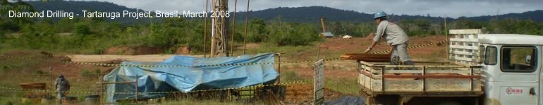
Tartaruga
Tartaruga Project- Amapa
Location of the Tartaruga Project in schematic reconstruction of Paleoproterozoic supercontinent
Tartaruga (DNPM 851.439/1980) - 96 km2
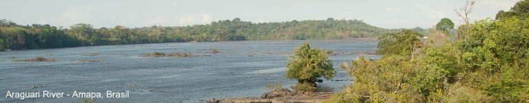
The Tartaruga Project is located in the northern most Brazilian state of Amapa, approximately 160km north of the state capital, Macapa. The project sits within the well regarded Villa Nova Suite, which is a regionally outcropping Paleoproterozoic greenstone belt forming part of the Guiana Shield.
Access to the project is via a major sealed highway which runs from the capital Macapa through the project area and then up the state's northern border.
The Tartaruga Project area comprises a mining concession title (DNPM-851.439/1980) under which an exploration permit has been granted and the final exploration report has been approved and which is now undergoing final approval by the DNPM for the issue, under the concession, of a mining permit. The mining concession title (DNPM-851.439/1980) covers a total area of 9,601.89ha. In 1981, British Petroleum acquired the tenement through their Brazilian subsidiary, BP Mineração. In 2004, the tenement was transferred to Keystone Ltda and subsequently to Brazmin in April 2005. Upon successful listing on the ASX, the Company's local subsidiary, Beadell Resources Mineração, will acquire 100% interest in the Tartaruga Project from Brazmin (subsidiary of Talon Metals Corp).
The Tartaruga Project is located within one of a series of Paleoproterozoic-aged greenstone belts in the south-eastern portion of the Guyana Shield. The Guyana Shield represents the northern segment of the larger Amazonian Craton in South America and is one of three crystalline shields that underlie approximately one-third of Brazil. The Guyana Shield covers an area of 900,000km2 and extends into the neighbouring countries of Venezuela, Guyana, Suriname and French Guiana. The Guyana Shield is interpreted to have once been joined to the West Africa Shield, a recognised gold province. Research completed in the past decade supports the theory that during the Paleoproterozoic (~2 Ga), the Guyana and West African Shields were joined as part of a supercontinent. Given the close geological correlation, the Guyana Shield greenstone-granite packages are considered to be prospective for mineral exploration.
Tartaruga Project interpreted geology and drill hole location map
The Tartaruga Project has a known gold deposit, Mineiro, which has been exploited superficially by artisanal gold miners known as garimpeiros who extracted gold from the alluvium overlying the deposit. Several smaller, less defined deposits exist along strike from the Mineiro pit and are possibly lateral extensions of the same mineralisation. These regions are known as Mandiocal, Bananal and Buração. Gold mineralisation is hosted in tabular quartz stringer veining from 1.4m to 13m wide within a sericite altered quartzite over a known strike length of 1,600m. Previous test work on the mineralisation shows it to be generally free milling with a minor sulphide and telluride association.
The main Mineiro deposit was diamond drilled by BP Mineração in 1985 and again by Brazmin in 2005. Snowden Mining Industry Consultants Pty Ltd completed the Independent Geological Report for the Tartaruga Project which included an assessment of previous mineral estimates. Over 6,000m of diamond drilling has been completed at the project including resource drilling of the main Mineiro zone over a strike length of 700m to a 50m by 20-25m grid. Snowden Mining Industry Consultants Pty Ltd estimate a target range of 2.0-3.2Mt at average grades of between 1.6 and 3.8 g/t gold. This target range is conceptual in nature; refer to 4.5.5 of the Independent Geologist Report in section 4 of the Beadell Resources Prospectus. Outside of the currently defined mineralised areas, the presence of large unexplored portions of the mapped sericite altered quartzite unit, recognised as the principal host to the gold mineralisation is considered to have positive exploration potential.